We recently presented our preliminary results in large-scale mapping of grass-clover leys at “Græsland 2018”, the largest grass-clover event in northern Europe, hosted by DLF.
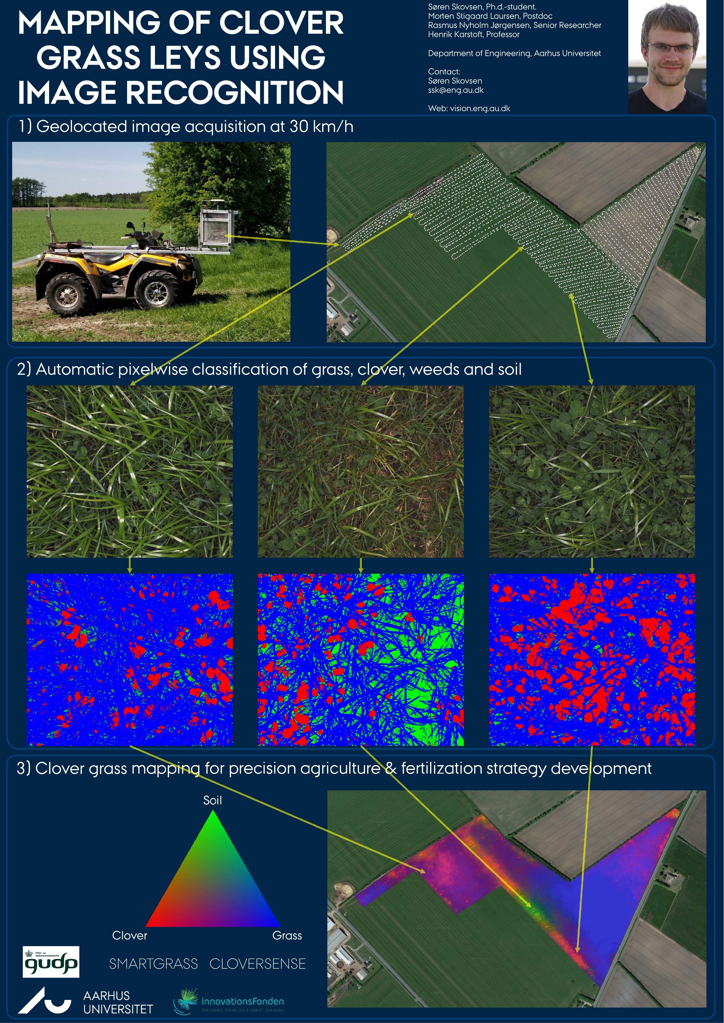
Using an ATV, numerous georeferenced images were collected a couple of days before the first harvest of the 2018 season. Using an automated segmentation of each image into grass (blue), clover (red), and soil (green), the spatial distribution of the three is qualitatively visualized across the field. The three sample images exemplify the corresponding distribution at the three points in space.
In the future, by mounting the camera directly on front of the harvester, the farmer can monitor his entire fields when harvesting, without the need for driving an ATV. This allows the farmer to optimize his fertilization strategy based on the condition and spatial clover/grass distributions of his fields.
For more information, contact Søren Skovsen.