CloudCast: A large-scale dataset and baseline for forecasting clouds
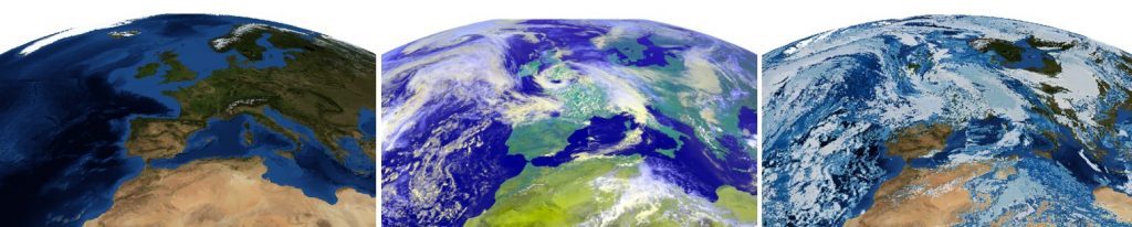
The CloudCast dataset contains 70080 images with 11 different cloud types for multiple layers of the atmosphere annotated on a pixel level. The dataset has a spatial resolution of 928 x 1530 pixels recorded with 15-min intervals for the period 2017-2018, where each pixel represents an area of 3×3 km.
To enable standardized datasets for benchmarking computer vision methods, we include a full-resolution dataset centered and projected dataset over Europe (768×768). To support small-scale experiments and analysis, we also include a downsampled low-resolution dataset 128×128 (15×15 km), which is significantly smaller in size compared to the full dataset.
Tutorial
Please see the following link for a tutorial on how to load, process and visualize the CloudCast dataset.
License

This work is licensed under a Creative Commons Attribution-NonCommercial-ShareAlike 4.0 International License.
Citation
If you use this dataset in your research or elsewhere, please cite/reference the following paper:
CloudCast: A Satellite-Based Dataset and Baseline for Forecasting Clouds
@article{nielsen2020cloudcast,
     title={CloudCast: A Satellite-Based Dataset and Baseline for Forecasting Clouds},
     author={A. H. {Nielsen} and A. {Iosifidis} and H. {Karstoft}},
     journal={IEEE Journal of Selected Topics in Applied Earth Observations and Remote Sensing},
     year={2021},
     volume={14},
     number={},
     pages={3485-3494},
     doi={10.1109/JSTARS.2021.3062936}
 }
Download links
Small Dataset (128×128, 249 MB compressed)