FieldSAFE – Dataset for Obstacle Detection in Agriculture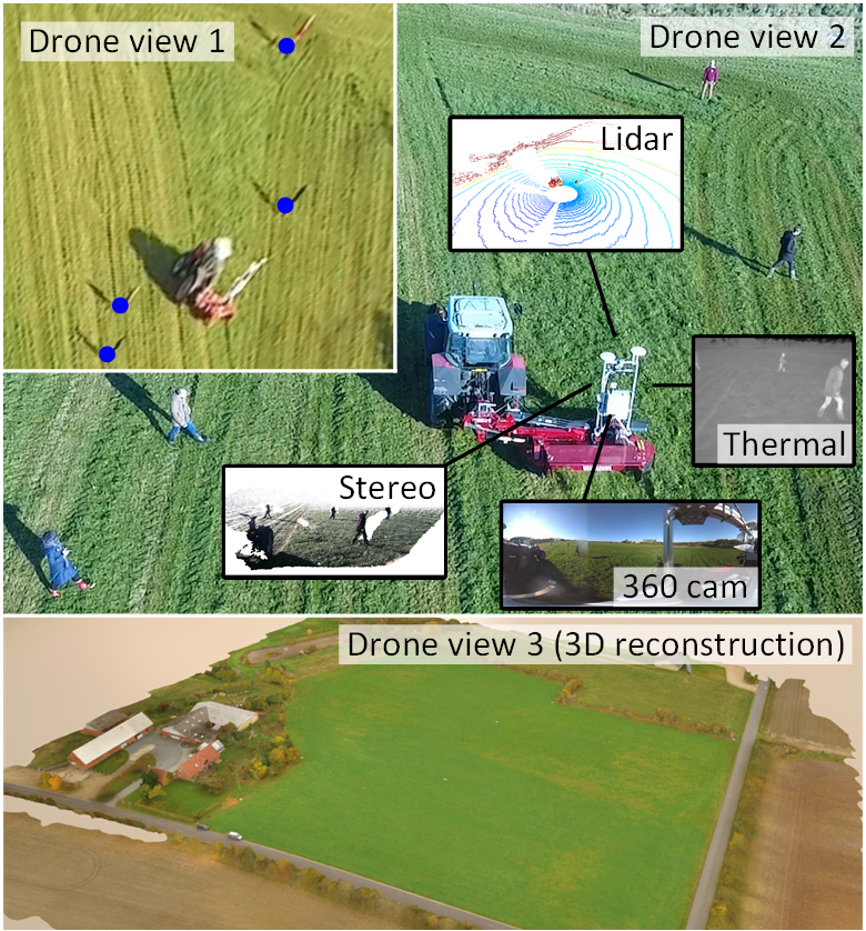
The FieldSAFE dataset is a multi-modal dataset for obstacle detection in agriculture. It comprises 2 hours of raw sensor data from a tractor-mounted sensor system in a grass mowing scenario in Denmark, October 2016.
Sensing modalities include stereo camera, thermal camera, web camera, 360-degree camera, lidar, and radar, while precise localization is available from fused IMU and GNSS.
Plant Seedlings Dataset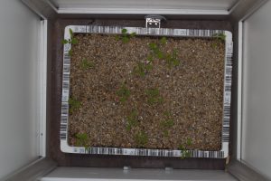
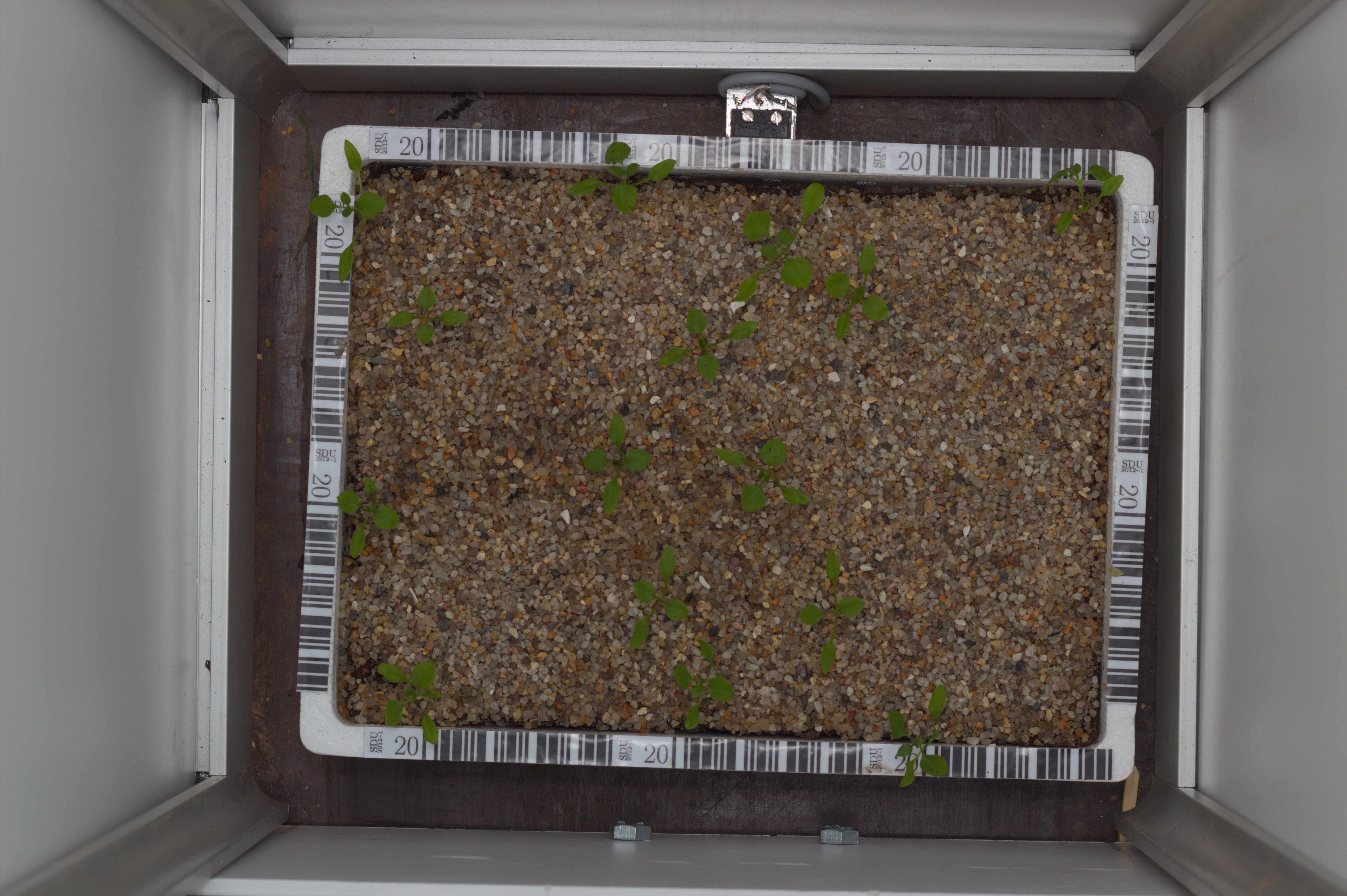
The Plant Seedlings Dataset contains images of approximately 960 unique plants belonging to 12 species at several growth stages.
It comprises annotated RGB images with a physical resolution of roughly 10 pixels per mm.
Grass Clover Dataset
The GrassClover dataset is a diverse image and biomass dataset collected in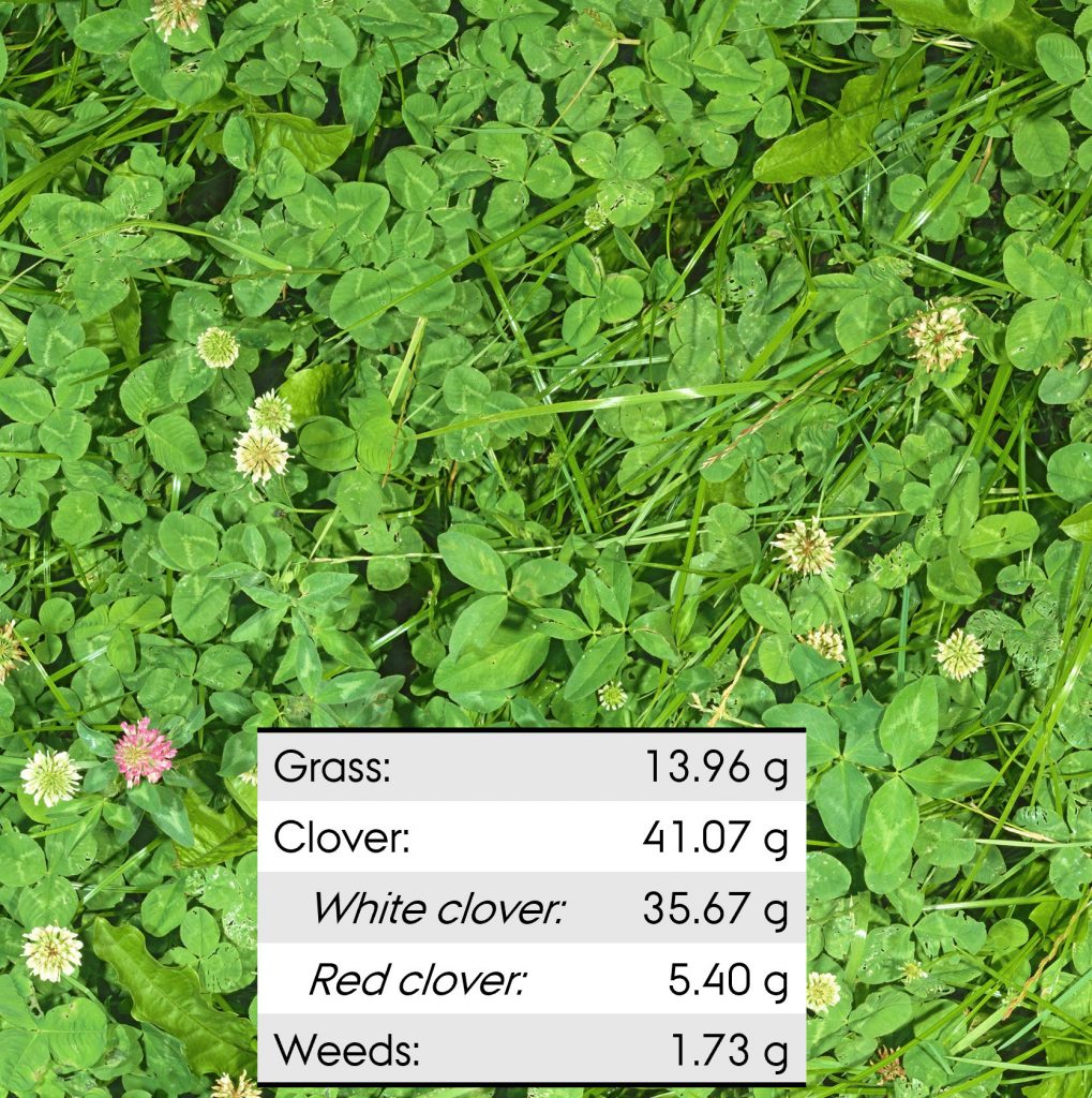 an outdoor agricultural setting. The images contain dense populations of grass and clover mixtures with heavy occlusions and occurrences of weeds. The dataset is collected with three different acquisition systems with ground sampling distances of 4–8 px per mm. The observed mixed crops vary both in setting (field vs plot trial), seed compositions, yield, years since establishment and time of the season.
Leaf Counting Dataset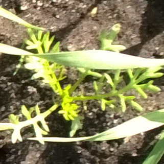
The Leaf Counting Dataset contains images of weed seedlings acquired under natural light conditions together with annotations telling the number of leaves. This data-set can e.g. be used for automated size estimation.
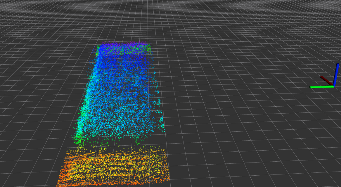
UAV Lidar Dataset
This dataset contains 3D LIDAR point-clouds of a field enabling canopy volume estimation and textural analysis, which can be used to discriminate different crop treatments.
We provided 3 example recorded data from an experimental field to the public.
All dataset are recorded as rosbags using the odroid platform.